EM field measurements are the composite responses to the subsurface resistivity, which is a result of differences between fluid content, lithology, and rock type. Mapping of the subsurface resistivity has proven to be a valuable tool in de-risking already identified prospects.To exploit the advantages of the EM technology, Allton works closely with exploration teams to increase the geological understanding of an area to address prospect specific challenges.
Allton will manage all phases of a project in cooperation with the client starting with initial sensitivity evaluations and survey design through acquisition and inversion. Incorporation of the EM data in each client’s unique geological model is done in close cooperation with the end user. Allton offers tailormade 2D and 3D acquisition solutions to fit different area challenges, geologic complexity and budget considerations.
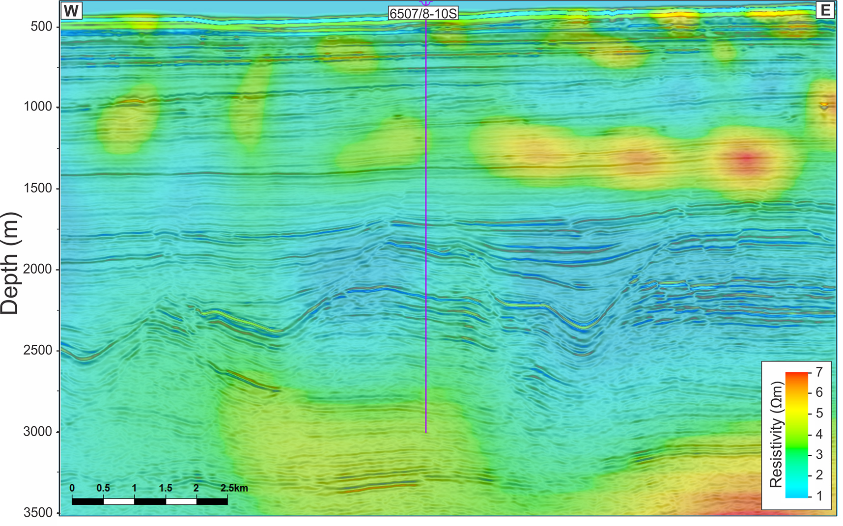
As an example, a client made a drop a license commitment based on a review of the geologic setting where a migration path was not confirmed and CSEM data did not indicate hydrocarbon accumulation
The 6507/8-10S well is dry and “No traces of Petroleum were proven” said the Norwegian Petroleum Directorate.